|
|
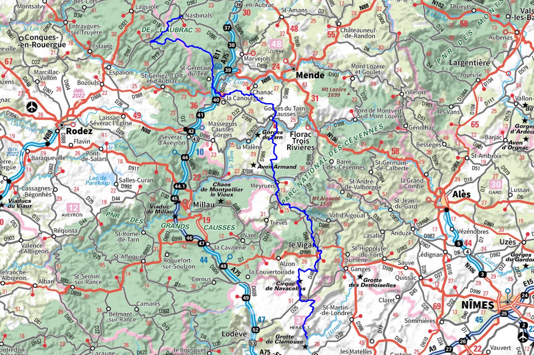
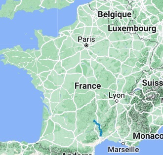
Hiking through Lozere, Aveyron, Gard and Herault department following Saint Guilhem trail from Nasbinals to Saint Guilhem-le-Desert. Guest House, Bed and Breakfast, Hotel, Camping, Shelter, Inn, Shops. |

219km
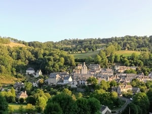
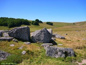
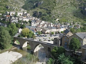
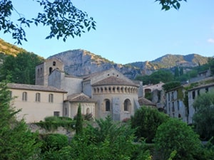
The origin of the Saint Guilhem Way dates back to the Middle Ages. It was originally a sheep transhumance route that linked the hinterland of Montpellier to the volcanic plateau of the Aubrac. Shepherds drove their flocks each season from the dry garrigues to the fresh and verdant pastures of the Aubrac. From the 11th century onwards, the Saint Guilhem Way also became a pilgrimage route. The abbey of Gellone, located in Saint-Guilhem-le-Désert, is an important pilgrimage destination due to the presence of the relics of Saint Guilhem, a warrior saint who retired to the abbey to lead a monastic life. Saint Guilhem d'Orange, or Guillaume d'Orange, was a Count of Toulouse who lived in the 9th century. He was a celebrated warrior, but he also led a troubled lay existence. After living a life of violence and debauchery, he converted to Christianity and retired to the abbey of Gellone to lead a monastic life. The legend of Guillaume d'Orange has been passed down to us through the epic song "Guillaume d'Orange". This song, which was composed in the 12th century, tells the exploits of Guillaume d'Orange as a warrior and as a saint. The Saint Guilhem Way is a popular hiking trail that is well-maintained and easy to follow. It is a great way to experience the natural beauty of the Languedoc region and to learn about the history and culture of the area.
 © GPX Private use only |
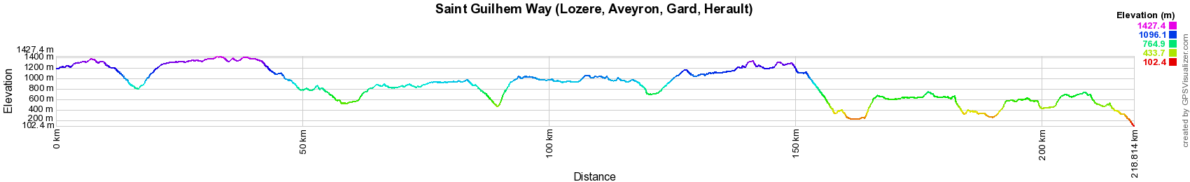
Distance: 219km, Elevation maximum: 1417m, Elevation minimum: 103m, Elevation gain uphill: 5436m
IGN Maps: 2537OT - NASBINALS MONTS D'AUBRAC. 2538OT - SAINTE-EULALIE-D'OLT HAUTE VALLÉE DU LOT MONTS D'AUBRAC. 2539SB - SÉVÉRAC-LE-CHÂTEAU LAPANOUSE. 2639SB - FLORAC SAINTE-ÉNIMIE GORGES DU TARN. 2640OT - GORGES DU TARN ET DE LA JONTE CAUSSE MÉJAN PARC NATIONAL DES CÉVENNES. 2641ET - MONT AIGOUAL LE VIGAN PARC NATIONAL DES CEVENNES. 2641OT - MILLAU GORGES DE LA DOURBIE CAUSSE NOIR. 2642ET - SAINT-GUILHEM-LE-DÉSERT CIRQUE DE NAVACELLES.
.
Registration Accommodation or business owner on or near a GR®, you can appear on GR-INFOS For your registration, you can send me by email (papadimitriou4@gmail.com): your address and phone number, your website (Facebook page), a brief description with 5 beautiful photos of your establishment. Registration price : 25€/year or 100€/5 years per GR® or GRP®. Renewable. |
|
Nearby paths:
Around Monts Aubrac (Lozère-Aveyron-Cantal)
Around Causse Sauveterre (Lozère-Aveyron)
Around Causse Méjean (Lozère)
Around Viganais (Gard)
Around Southern Larzac (Herault-Gard)
Around Grand Pic St-Loup from Seranne to Herault gorges
Around Grand Pic St-Loup between Londres and Bueges (Herault)
GR®6 From Gironde to Alpes-de-Haute-Provence
GR®7 From Vosges to Pyrenees
GR®60 From Signal de Mailhebiau (Lozere-Aveyron) to St Mathieu-de-Treviers (Herault)
GR®62 From Roque Rouge (Gard) to Conques (Aveyron)
GR®62A From Combescure Ravine (Aveyron) to Meyrueis (Lozere)
GR®65 Via Podiensis Camino de Santiago de Compostela
GR®66 Around Mt Aigoual (Cevennes National Park)
GR®71 From L'Esperou (Gard) to Lodeve (Herault)
GR®74 From St Maurice-Navacelles to Jouquet (Herault)
GR®653 Via Tolosana - Way of Arles
GR®670 Urbain V Way
GR®736 Tarn Valley and Gorges
![]() It is advisable to follow the beacons all along your hike and to bring you the FFRandonnee topo-guide. You
will also find information on MonGR.fr.
It is advisable to follow the beacons all along your hike and to bring you the FFRandonnee topo-guide. You
will also find information on MonGR.fr.
GR®, PR®, GRP®, and the corresponding signs of markings (white / red, yellow and yellow / red) are trademarks of the French Federation of Hiking. They may not be reproduced without permission. The French Federation of Hiking, state-approved, includes organizations that create and maintain hiking routes on GR®, PR® and GRP®. It publishes guides these topo hiking routes.
With your donations, support the actions of the thousands of volunteer markers of the FFRandonnee.
GR-Infos.com is an editorial partner of MonGR.fr.

|
| Return |
Old romantic Hotel, L'Etoile Guest-House is a mountain retreat in the South of France. With a beautiful park along the Allier River, L'Etoile Guesthouse is located in La Bastide-Puylaurent between Lozere, Ardeche and Cevennes. Many hiking trails like GR®7, GR®70 Stevenson trail, GR®72, GR®700 Regordane way, Cevenol, GR®470 Allier River Springs and Gorges, Margeride, Ardechoise. Many hiking loops. The right place to relax.
Copyright©gr-infos.com (Authorization for private use only)